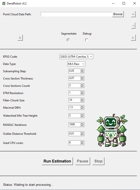
DendRobot
An automated tool for 3D data based forest inventory.
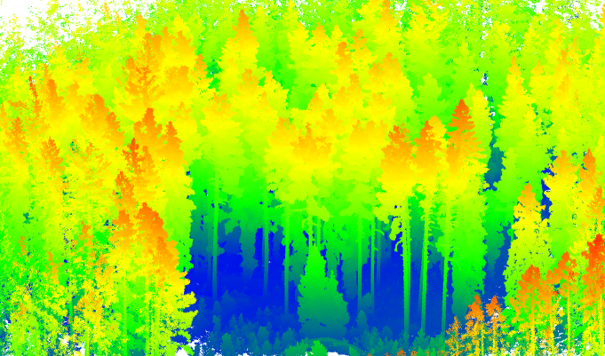

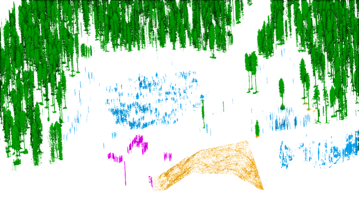
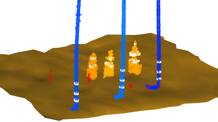
Processing terrestrial 3D data from LiDAR scanning or photogrammetry and obtaining results on the individual tree level, resulting in shapefiles containing core tree parameters.
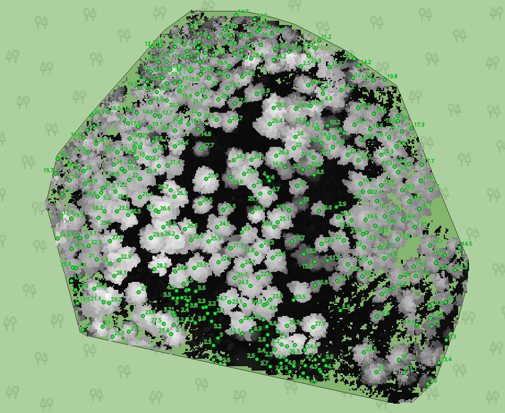
Clear overview of tree attributes in GIS layers.
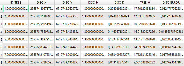
Individual tree segmentation and tree taper derivation.

All of this is obtainable with a single mouse click.